Day 9 Saturday, Sep. 04 -- Milford Sound to Routeburn Track
Synopsis
Sure enough, we got stuck in the snow on the way out of Milford Sound, but we managed to get some chains on the van and made it out ok (although we lost a chain on the way over the pass). We briefly explored the Hollyford Valley, viewing a couple of neat waterfalls and encountering a crotchey old man who appeared to live separated from the rest of the world, both physically and mentally! We then set out on the first part of the Routeburn Track then took Greenstone Track and spent a very cold night at the KcKeller Hut.
Detailed Journal
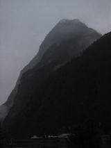
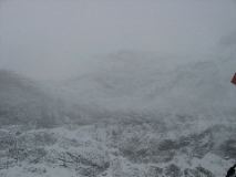
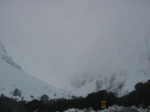
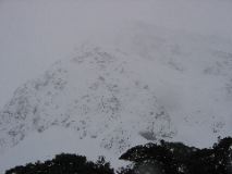
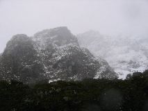
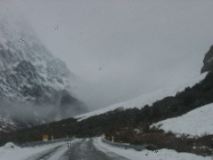
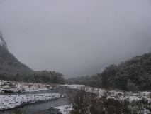
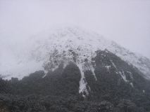
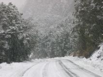
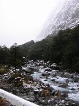
We got up around 7:30, got ready to go and went to the Milford Sound Visitor’s Center, about 500m up the road from where we camped. The person at the counter didn’t seem to know what was going on so much, but he told us that it was already snowing at the top of the pass and that he didn’t know when the snow would stop. At this point, Jason was convinced that we probably should not tramp up the Routeburn Track for the night. We headed out of town quickly since we didn’t want to get closed in because of the snow. Turns out that we were a bit too late to make it out uneventfully. About 5 minutes after we left the Milford Sound village, we were slip-sliding our way up a hill. After several attempts to make it up the hill, we decided to put on our chains (Lynette’s first experience putting chains on a vehicle). We struggled with that for about a half hour, and after two attempts (and some very cold hands), we had successfully put them on. The rest of the journey over the pass was a breeze with the chains on (it helped that about half way up, a plow passed us). The scenery was a pretty drastic change from the day before, from a beautiful sunny day to a snowy day (with a beauty of its own).
After about an hour, we reached the point at which we had been stopped the day before for yesterday’s road closure. Apparently while we were crossing over, they had decided to require chains on all vehicles, so there was a man there from the Works Infrastructure (like the D.O.T. in the U.S.) making sure everyone did as the sign said. We pulled over there to take off our chains, however Lynette quickly realized that we were one chain short of a pair. Somewhere along the way we had apparently thrown the chain off our left rear wheel. We briefly considered going back to look for it, but after talking to the Works Infrastructure man, we gave up on the idea. He said that he would tell the plot drivers to keep a look out for it and would return them to their yard in Te Anau if anyone found them. We did glean some good news off the man who told us that he was expecting the snow to lift in the afternoon and that the next day should be nice. We were a bit disappointed about the missing chain, but oh well, what are you gonna do? However, we had a new optimism about the possibility of hiking the Routeburn Track.
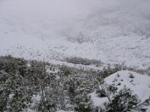
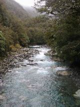
We drove up the Hollyford Valley Road (a branch off the main road between the Milford Sound and Te Anau) in search of a few walks that the lady at the DOC had told us about the day before. Along the way, we stopped at Gunns Camp to ask for information about the weather and the possibility of traversing the first day of the Routeburn Track (we saw a DOC truck out front so we figured they would be someone in the know). About a minute after we walked into the deserted shop, a man who could only be described as a crotchety old man greeted us. We told him that we were looking for some information, and before we could ask our question he said, “I don’t know nothing about when the road is going to open”, which was particularly amusing since the road was open. So, we told him that we were actually wanting to know what the Routeburn track would be like and if he had heard anything about the weather. He grumbled something about the Routeburn Tracking looking kind of snowy, but then he said that a DOC officer was in the kitchen and went to get him. The DOC guy seemed to agree that the weather was going to clear up and that the hike into the first hut would be fine. He also agreed to fill out a form of intent at the DOC office in Te Anau for us, so we were all set for an official New Zealand tramp along one of the “Great Walks.”
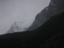
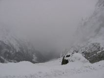
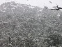
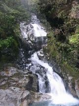
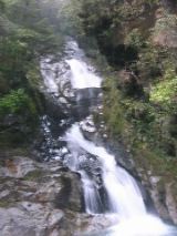
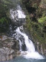
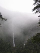
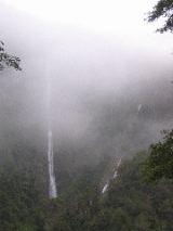
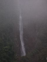
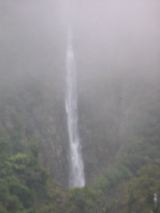
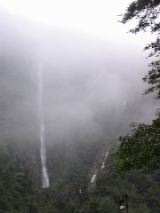
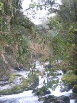
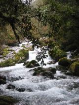
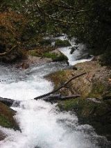
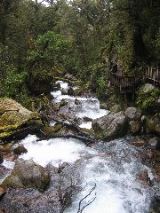
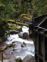
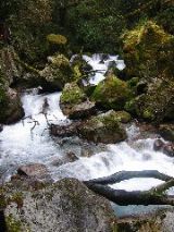
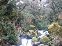
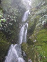
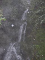
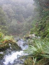
Before our backpacking trip, we continued up the Hollyford Valley to the Humboldt Falls, which involved a 30 minute round trip to a narrow, but towering 3-tiered waterfall. The bottom two tiers were clearly visible, but the top tier was masked by the low clouds and could barely be made out. It made for a pretty dramatic effect. Following Humboldt Falls, we headed back along the Hollyford Valley to the Lake Marion trail. We hiked up about 10 minutes to a series of small waterfalls that weren’t much more than a series of large boulders. It was pretty none-the-less and worth the jaunt. When we got back to the van, we ran into a man from England who was in the middle of a one-year journey around the world. He was an interesting man and we spent about a half hour talking about our travel experiences, bungee jumping, evolution of the Earth (both Hawking and Bryson(?)), and a variety of other random subjects. He seemed to not want the conversation to end and we wondered if he was lonely from all his travels.
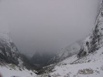
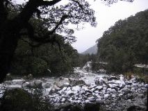
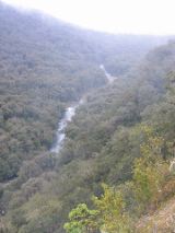
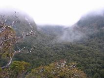
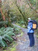
From there we headed to a place called the Divide, which was the trailhead for the Routeburn Track and the trail to Key Summit (which lies just off the Routeburn Track). We filled our packs with a night’s worth of food, dry clothes and camping gear and an hour and a half later we hit the trail. We met a couple who had just hiked up to the Key Summit track split and they told us it wasn’t a bad hike, but it was “whiteout” at the top. We felt confident that we had the proper gear and trudged on. It was a steady climb for the first hour, but we were rewarded by a few waterfalls (one rather spectacular on that we crossed about mid-falls on a small wooden bridge). The valley below us was not visible through the low clouds, and as we looked through the trees into the empty grey backdrop, Lynette made a comment about it being God’s blank canvass. We both thought it was a pretty neat way of looking at it. We took a picture and remembered the spot so that the following day we could take the same picture once God had finished his painting. Right about the time we hit the trail split between key summit and the Routeburn Trek, we encountered some other obviously overnight trampers (oddly, though, they were spaced about 100m apart). They seemed exhausted, wet and cold, but we didn’t let that stop us. Besides, we weren’t going nearly as high as they had come from. They had started at the bottom of the Routeburn and hiked the entire thing. Lynette mentioned to them that the DOC had warned us against going on the Routeburn below the Howden Hut. The guy kinda shrugged his shoulders and said, “yeah – it was kinda rough – we hit a blizzard yesterday that was pretty rough”. One of the girls in the group told us that there was no dry wood in the Howden Hut so we probably couldn’t get a fire started. We parted the other hikers and made the final 15-minute hike to Lake Howden and Howden Hut. Once inside, we confirmed the lack of dry wood and noticed that we were both very cold in the hut. There was a sign out front with directions to continue on the Routeburn Trek for 4-5 hours to McKenzie Hut or 2 hours to the McKeller Hut on the Greenstone Trek. Lynette got out the New Zealand Tramping Guide to look up the other huts. The Greenstone Trek was described as a low-lying track and therefore you could tramp it any time of the year. Also, the book called out a neat hike that went up to peak 1538 then down through Key Summit, then returned to the Divide. So, there stood the Stauch’s at 440pm in the Howden Hut. We could stay there for the night, as planned (however without ability to make a fire), and hike to Key Summit on the way out then hike to the Divide the next day OR we could continue our adventure by hiking to McKeller Hut, possibly hiking in the dark, with the chance of not only having a fire to warm the hut but also some more incredible views than we could get from the Howden Hut. What do you really think we chose?
That’s right, at 450pm, Lynette grabbed a small handful of matches from a box on the counter (just in case because we forgot to throw ours in when we left), we loaded back up with our gear, and set out on a mission to complete the DOC estimated 2 hour hike to McKeller Hut before the sun went down. We started with a really strong pace and were soon faced with multiple fallen tree obstacles within our path that made us wonder how much hiking we were going to do with a flashlight. We passed the Howden campground after what seemed like forever, but only 18 minutes had passed. We trudged on through more forest until we came to a clearing, offering quite a view, despite the grey clouds lurking close the mountaintops. With the good views, the clearing came with a bad side… it was a swampy bog. It was actually grass tufts that had been soaked, so pretty much every step we’d take, our boots would half sink into water. We hopped and tiptoed our way through the bog, past the Caples Track (which lead to a hut 6-8 hours away), and back into the forest. The last half hour dragged on as twilight fell, but we finally made it to the McKeller Hut, and it wasn’t even fully dark. Yeah! We trudged into the hut and Jason unloaded our stuff while Lynette read the instructions to light the wood stove. There wasn’t any newspaper at this hut (like there was at Howden Hut), but there was dry wood, lots of kindling, and some scraps of paper towel and cardboard, so we were in business. We built up a small stack of kindling and went to light it with the matches Lynette had grabbed from Howden, but to our great disappointment, the matches would not light on the stove, and we were fresh out of flint strips. This was a huge let down because it was really setting in how cold we were.
We decided to jump into the dry clothes we had brought and then into our sleeping bags, which would be the quickest way to warm up at this point. We also broke out several sets of hand warmers. Jason started warming up quickly, but Lynette only seemed to get colder. We soon realized that it was probably because her hair was soaking wet. Jason grabbed a towel that another tramper had left behind and dried Lynette’s hair as much as possible, but the warming process was still very slow. We were both quite concerned about the situation, but eventually she began to warm up (the three hand warmers inside her sock hat were the key). We each ate a peanut butter and jelly sandwich, and then did our best to fall asleep for the night. At this point, we just wanted the night to be over.
Pictures
IMG_0436
|
IMG_0437
|

IMG_0438
|
IMG_0439
|
IMG_0440
|
IMG_0441
|
IMG_0442
|
IMG_0443
|
IMG_0444
|
IMG_0446
|
IMG_0447
|
IMG_0448
|
IMG_0449
|
IMG_0450
|
IMG_0452
|
IMG_0453
|
IMG_0454
|
IMG_0455
|
IMG_0458
|
IMG_0459
|
IMG_0460
|
IMG_0461
|
IMG_0462
|
IMG_0463
|
IMG_0464
|
IMG_0465
|
IMG_0466
|
IMG_0467
|
IMG_0468
|
IMG_0469
|

IMG_0470
|
IMG_0471
|
IMG_0472
|
IMG_0473
|
IMG_0474
|
IMG_0475
|
IMG_0476
|
IMG_0477
|
IMG_0478
|
IMG_0479
|
IMG_0480
|
IMG_0481
|
IMG_0484
|
IMG_0485
|
IMG_0486
|
IMG_0487
|
IMG_0492
|
IMG_0493
|
IMG_0494
|
IMG_0495
|
IMG_0496
|